
Wood County ZIP Coverage
The Wood County ZIP code directory begins with postal labels found in USPS material and county-boundary research. A label describes mail delivery, not a legal city or county boundary. Standard delivery areas are the safest broad categories. Box-oriented, special, and partial-area codes need an address-level check before they are tied to a physical place.
| ZIP | Area Label | Post Office Type | Wood County Note |
|---|---|---|---|
| 26101 | Parkersburg | Standard delivery | Use street and unit for a precise result |
| 26102 | Parkersburg | PO Box | Not a physical parcel address |
| 26103 | Parkersburg | PO Box | Confirm deliverability |
| 26104 | Parkersburg | Standard delivery | Parkersburg-area route |
| 26105 | Vienna | Standard delivery | Postal and legal-city lines can differ |
| 26106 | Parkersburg | Special or unique lead | Exact facility was not confirmed |
| 26120, 26121 | Mineral Wells | Special or unique leads | Verify each address with USPS |
| 26133 | Belleville | Standard delivery | Wood County community label |
| 26142 | Davisville | Standard delivery | Wood County community label |
| 26143 | Elizabeth | Partial or adjacent | Do not assume county coverage |
| 26150 | Mineral Wells | Standard delivery | Wood County-area label |
| 26164 | Ravenswood | Partial or adjacent | Address check required |
| 26169 | Rockport | Standard delivery | Wood County community label |
| 26180 | Walker | Standard delivery | Wood County community label |
| 26181 | Washington | Standard delivery | Wood County community label |
| 26184 | Waverly | Standard delivery | Wood County community label |
| 26187 | Williamstown | Standard delivery | City delivery label |
This table is deliberately cautious. Research did not locate an official complete crosswalk from every ZIP boundary to the Wood County line. Codes 26143 and 26164 remain adjacent or partial flags. The exact facilities behind special classifications for 26106, 26120, and 26121 were not confirmed in the official pages inspected.
For standard-delivery labels, the code still covers a route rather than a fixed neighborhood. One ZIP may include city blocks, rural roads, and addresses outside an incorporated line. Use the table to choose a USPS search, then test the actual street and unit. That address-level result is more dependable than assigning every household under a postal city name to the same local jurisdiction.
Parkersburg ZIP Codes Differ
Parkersburg's 26101 through 26106 range does not describe six equal geographic slices. Codes 26101 and 26104 are standard delivery labels. Codes 26102 and 26103 are box-oriented. Code 26106 appeared as a special or unique classification lead, but research did not identify the exact facility from an official USPS page. A box code should never stand in for a street parcel.
The USPS DMM L012 label list places the Parkersburg range in national routing material. That source helps confirm labels, but it does not name residents or settle municipal boundaries. Save the publication date when using postal bulletins for historical work because routes and labels can change.
Search Wood County USPS Fields
The official USPS ZIP Code Lookup provides three useful modes. Use By Address when a street is known, By City and State when only the postal community is known, and Cities by ZIP when checking a supplied code. Multiple matches should be narrowed with the street and unit. The result standardizes a mailing address; it does not confirm that a person or firm occupies it.
| Mode | Field | Requirement |
|---|---|---|
| By Address | Company | Optional |
| By Address | Street Address | Required |
| By Address | Apt, Suite, Other | Optional narrowing field |
| By Address | City and State | Required |
| By Address | ZIP | Optional |
| By City and State | City and State | Required |
| Cities by ZIP | ZIP | Required |
The captured USPS form shows the by-address entry point used to normalize Wood County mail.
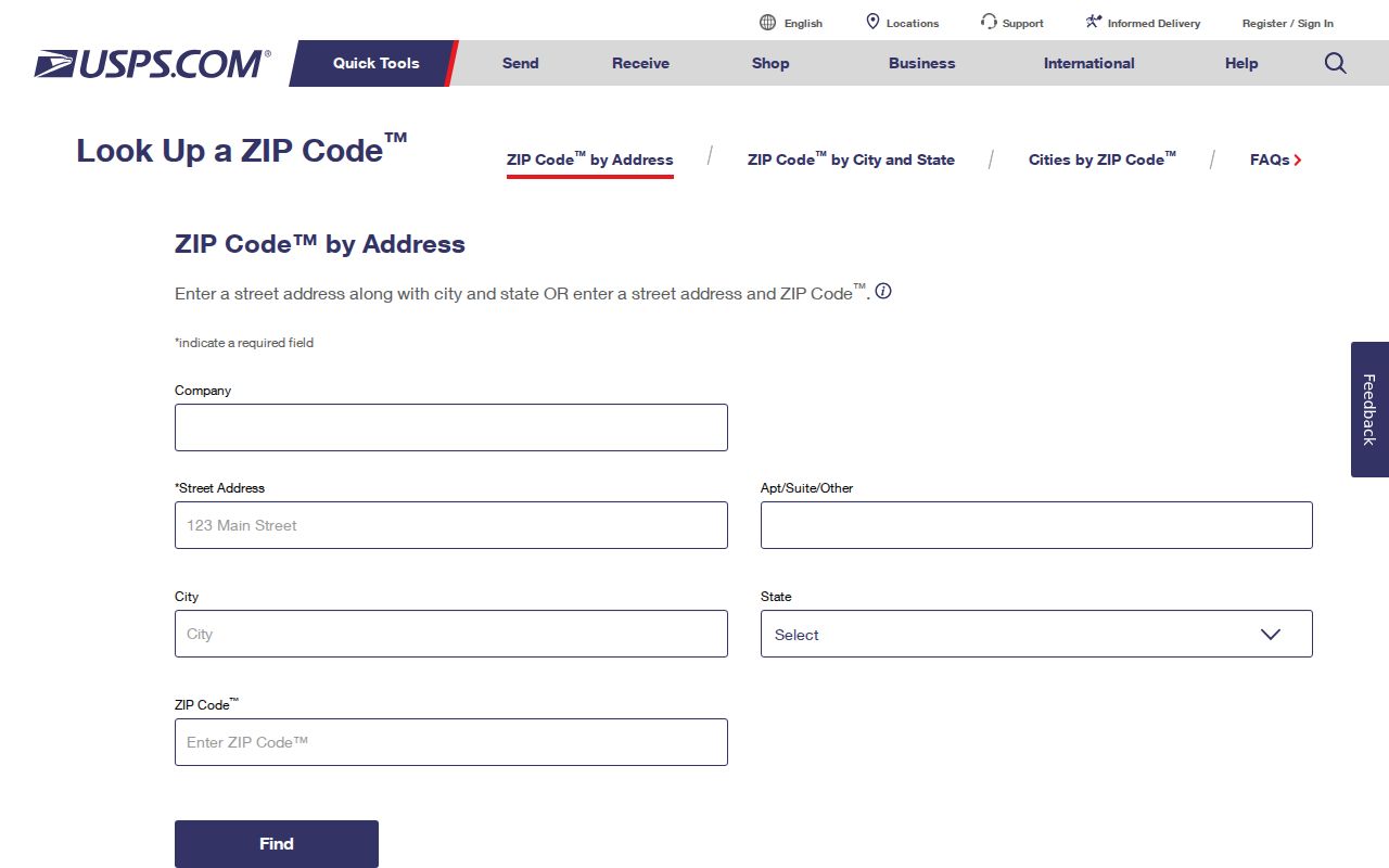
Use the returned spelling and ZIP as the postal version, then compare it with the county's own parcel and assigned-address fields.
Narrow a Wood County ZIP Search
No inspected Wood County portal provides a simple ZIP-wide list of people. CAMA has no ZIP field. The deed index uses names, dates, document types, and recorded references. The voter lookup requires an individual's first name, last name, and date of birth. Its output can include districts and polling place, but not a public ZIP roster.
- Choose the USPS search mode that matches the input: full address, city and state, or supplied ZIP.
- Save the standardized street, unit, city label, state, ZIP or ZIP+4, and lookup date.
- Compare the result with the Parcel Address in Wood County CAMA and the assigned address in county mapping or E911 records.
- Record any difference as postal, parcel, or assigned-address wording instead of forcing one value to replace the others.
- After narrowing to a road, use the Wood County street directory process parcel by parcel.
This method finds records connected to a known place. It does not promise that every owner, voter, or occupant inside a delivery area can be retrieved by ZIP.
Why Wood County CAMA Lacks ZIP
The assessor's CAMA form searches owner, Parcel Address, account, district, map and parcel, property type, legal description, and deed book and page. ZIP is absent. That is not a defect. The assessor organizes parcels for assessment, while USPS organizes delivery. A parcel ID or legal description is often the stronger county key.
If an address search fails, open the Wood County Address Map for orientation, then retry CAMA with the parcel identifier or exact county wording. The viewer's detailed layer names were not exposed during text inspection, so no ZIP filter should be claimed without a live visual check.
Note: Preserve both the tax mailing address and parcel address when they differ; each field answers a different records question.
Wood County E911 Address Quirks
The Wood County E911 office assigns physical addresses from measured driveway distance. The researched convention places even numbers on the right and odd numbers on the left. A shared drive serving three or more homes can require a road name, with written agreement from at least 70 percent of owners and a name that is not already used in the county.
After application, the office reports a GPS site visit and an estimated three to four working days before the applicant calls for the assigned number. That assigned address may not match an old route, informal place name, tax mailing address, or directory-era wording. USPS should still make the final postal check. E911 establishes the county's physical-address layer, not a list of occupants.
This distinction matters most on rural roads and shared drives. A tax card may carry a mailing address used for notices, while E911 records the site reached by emergency services and USPS supplies the preferred delivery line. Keep all three labels with their source names and access dates. The Wood County ZIP code directory can narrow the postal area, but the E911 number and parcel identifier do the harder work of distinguishing nearby tracts.
Wood County ZIP Boundary Limits
Vienna's 26105 and Williamstown's 26187 are clear postal labels, but their delivery areas must not be treated as exact city polygons. Elizabeth 26143 and Ravenswood 26164 appear only as partial or adjacent areas in the researched boundary and routing material. An address may use a familiar town label while falling outside that municipality, or it may sit in Wood County under a neighboring postal label.
- ZIP
- A postal delivery area identified by five digits, not a legal boundary.
- ZIP+4
- Four extra digits that narrow delivery to a smaller segment, box group, or building.
- PO-box ZIP
- A code used for mailboxes rather than as a physical street location.
- Unique ZIP
- A code assigned for a special or high-volume delivery purpose; confirm the exact recipient.
- Carrier route
- A USPS delivery path within a broader ZIP area.
Boundary check. Confirm the USPS address first, then use CAMA, GIS, E911, or municipal records to establish county, parcel, and city context.
Research Older Wood County ZIPs
No official Wood County history of ZIP creation, retirement, or realignment was located. Do not invent a split year or assume today's code applied to an old address. Dated USPS Postal Bulletins can establish the routing labels in use at a point in time. The official Wood County road map, last issued in 2014 with a 2013 revision date, can add named-road and post-office context, but it is not a current ZIP boundary map.
Historical Parkersburg directories may use corner descriptions, fractions, old place names, or a home marker rather than a modern postal line. Current USPS results cannot prove a 1907 location. Preserve the old wording, find the street on a period map, and document only the modern match that the evidence supports.
The same care applies outside Parkersburg. Belleville, Davisville, Mineral Wells, Rockport, Walker, Washington, Waverly, and Williamstown are useful postal labels, yet a label alone cannot establish the city government, tax district, school district, or owner tied to an address. Compare a dated postal source with CAMA, the county road map, and the correct municipal records. A ZIP code directory organizes delivery evidence; it should not erase local place names or claim that every route shares one civic boundary.
For family history, write down each version of the place exactly as printed. A newspaper may name a community, a deed may use a tract and district, and a later letter may use a ZIP. Those can refer to the same general place while answering different questions. The most reliable conclusion states the source and date for each form.